WPRB is IMPACT!
Text: Rob Schuman
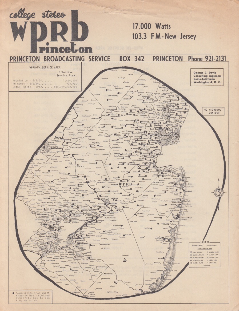
This is one of the first coverage maps from WPRB, produced shortly after the station went to full 17,000 watts of effective radiated power. Mapping radio reception is a tricky business, even today. FM waves don’t go around objects the way AM signals do. You just don’t know how far your signal will go until you actually go out and measure it. This is therefore an approximation of signal strength based on a 50 microvolt signal contour, which, I am told, means that you can still get it some places with a strong antenna, and a good FM tuner, and the luck of good geography.
Probably the most interesting thing about this map is the fact that there is a blank space where New York City is located. It’s almost as if New York didn’t exist (and it didn’t so far as WPRB was concerned, since it was probably overwhelmed by the neighbor stations on 103.1 and 103.5. In any event, it was designed to be used by the sales department to show how powerful we were.
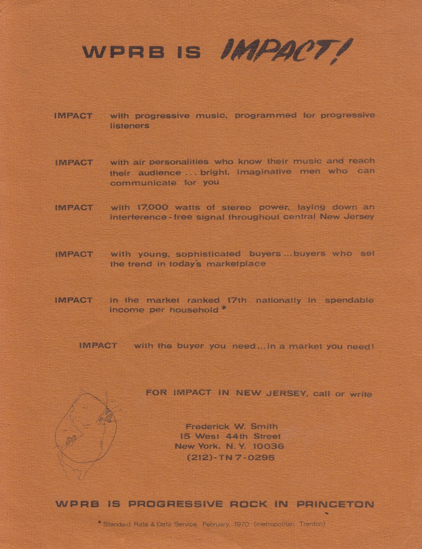
The WPRB is Impact [flyer] was actually printed by our “National (ad sales) Rep”. He represented several of the Ivy League stations for national advertising. In the years he served I don’t believe he sold any advertising, but since he was paid on commission there was no down side. The fine print at the bottom quotes from the SRDS (Standard Rate and Data Service–the bible of the broadcast advertising industry) from February of 1970 so it probably dates from that year or 1971.